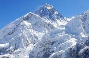
Measuring the height of Everest
– Buddhi Narayan Shrestha
The Survey Department has planned to measure the height of Mt Everest to settle doubts that the world’s tallest peak may have become shorter as a result of the vicious 2015 earthquake. Surveyors from many countries have calculated the altitude several times in the past and come up with different figures. In 2005, a Chinese team measured the height at 8,844 metres while in 1999, US experts computed it at 8,850 metres. The height of Everest was first calculated in 1852 by British India surveyors who declared the summit to be 8,840 metres high. The most used figure of 8,848 metres was determined by Indian surveyors in 1954.
Methods of measurement
The Survey Department recently organised an international workshop entitled Measurement of the Height of Mt Everest and Global Navigational Satellite System Application to discuss and finalise the measurement methodology to determine the height. Experts from the US, Switzerland, Italy, New Zealand, Japan, India, China and Nepal took part in the meet. It was agreed that precise levelling alignment would be connected to the new adjusted Indian levelling network. It will be extended to four observation stations. The accuracy will be 2 mm/km. The absolute gravity station will be established in the vicinity of the start of the new leveling alignment, and observations will be carried out every 2 km along the precise leveling route.
Surface gravity observation in the Everest region will redefine the geoid model with densification of surface gravity observations to obtain better accuracy. Four stations will be continously occupied by GPS (global positioning system). Trigonometrical surveys will be operated and lines of sight will be observed from the triangulation stations. Vertical and zenithal angles will be observed from 12 stations. Meteorological data will be collected from the Ev-K2-CNR High Altitude Research Project at Lobuche and the Department of Hydrology and Meteorology. The department has started the construction of a Radiosonde Balloon Station in Kirtipur. The balloon flies every day up to a height of 18-20 km. It transmits data on temperature, atmospheric pressure and humidity to the receiving station.
GPS observation will be carried out in Permanent Bench Marks (every 2 km) on the leveling routes. It will be carried out on several stations in the Everest region during the observation period. Finally, GPS observation will be made on the summit by the expedition team. Simultaneously, snow height will be measured through Ground Penetrating Radar for snow depth determination. In this way, the height will be calculated using a combination of geodetic data received from three mechanisms: levelling instrument, gravity metre and GPS to obtain the rock height.
There will be correction measures for refraction, deflection-of-vertical, geoid height, atmospheric anomalies and the exact thickness of the ice on the summit. Sufficient attention will be given to minimise instrumental and human error while measuring, computing and calculating the final height precisely according to international norms and standards. A mountaineering expedition will be mounted during the summer or autumn climbing season to measure the height with the set methodology. A team of Sherpas will climb to the top of Everest with measuring equipment.
Taking responsibility
The world is looking at Nepal as measuring Everest is a challenging task and it is also an opportunity. They wonder whether Nepal is capable of measuring Everest and if it has sufficient money. Nepal has the capability as it has internationally sound technical manpower with academic education and practical training. Nepal needs scientific equipment and tools like standard GPS receivers, precise levelling equipment and absolute gravimeters although it has a few instruments and tools of its own. The necessary instruments will be procured or hired from international agencies and organisations like the International Association of Geodesy and instrument manufacturing factories. The government will make an adequate budget allocation next year as measuring the height of Everest has been made a national priority project.
It would be good to involve India and China in the project. After all, it was the Survey of India that discovered the highest mountain in the world in 1852 and named it Peak XV. In 1865, it was named Everest. The reason for involving China is that Everest is located on the Nepal-China border. Everest can be climbed from both the Nepal and China sides. So it would be appropriate if the Nepali team is joined by Chinese and Indian teams. The Surveyor General of India has sent his best wishes to the Survey Department for the success of the measurement of Everest. He has said that measuring Everest by Nepal is a welcome step. Chinese participants have suggested measuring the peak collaboratively with joint surveys, observations and measurements. They have pledged to extend cooperation.
Everest is Nepal’s treasure and heritage, so it has to measure the mountain and determine the accurate height. Nepal, home to Everest, has never measured the peak on its own, but this is our responsibility as well. It’s a matter of pride and prestige for the country to measure Everest by itself. So Nepal must perform the measurement scientifically and determine the authentic and latest height that will be acceptable to the world’s scientists and researchers.
– Shrestha is a former director general of the Survey Department and border researcher
Jan. 2018