Reshaping Geography of Nepal
– Prof.Soorya Lal Amatya–
Nepal, the birth place of Lord Buddha with glorious shrines and Mt. Everest,the highest peak of the world is an independent country on the southern lap of the Central Himalayas. It is a country of ancient civilization,rich in cultural and artistic wealth. Being a landlocked and mountainous country, Nepal has her own geographical and cultural entity. Nepal is one of the least developing countries in the world. The country’s economy is basically agricultural and the standard of living of the people has remained miserably low.But Nepal is naturally bestowed with natural resources. The country is rich in raw materials, natural resources, bio-diversity and manpower. Both of the natural and human resources are to be mobilized in a planned and integrated way for the development of the country. Geography plays a very important role in the economic development of the country.In a country which is backward in science and technology,the effect of geographical conditions is obvious.
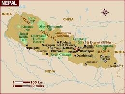
Nepal was a Hindu country for a long period in the past but now it has been declared a secular country.It is located between 26` 22′ N and 30` 27′ N latitudes and 80`04’E to 88` 12’E longitudes. The country is more than three times longer than its width.The length from east to west is about 885 km and the breadth from north to south is about 193 km. The country as a whole assumes an irregular rectangular shape thrusted north-westwards.The total area of the country is about 147,181 sq.km.It is bounded by the Singaliha range and the R.Mechi in the east and the R.Mahakali in the west whereas in the north it is bounded by the main Himalayan range in the eastern section and by border ranges in the western section and in the south boundary pillars have been erected to demarcate the boundary between Nepal and the Indian states of Uttaranchal, U.P., Bihar, West Bengal and Sikkim.
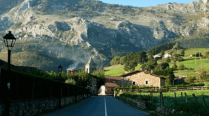
About 80 per cent of the total area of Nepal is covered by mountains, hills and rough terrains. The lowland areas of Terai accounts for about 17 per cent of the total land area. The Terai and the Inner Terai regions together account for about 23 per cent of the total area. The general surface of the country is highly rugged. In the south,it is less than 300 metres above the sea level and the lowest altitude of Kachakalan in Jhapa district is 70 metres and rises more than 8800 metres in the north.The general slope of the country is towards south.Nepal has considerable areas of plain in the south and some broad valleys in the midland pahar region.
Nepal was part of the great geosynclinals Tethys Sea in the distant geological past. Deposition of sediments continued for a long period in the Tethys Sea and it was in the Cretaceous period, the whole area was gradually uplifted and since then it has undergone a series of upheaval and culminated in the Pleistocene period. The Himalayan Mountain is still believed to be rising gradually. Thus the Tethys Himalaya, the Great Himalaya, the Middle Himalaya (the Mahabharat range), and Sub-Himalaya ( Chure range) were formed.
Dr. Toni Hagen has depicted seven major physical divisions of the Terai, the Siwalik, the Mahabharat Lekh, the Midlands, the Himalayas, the Inner Himalayas and the Tibetan Marginal mountain range. Dr. Harka Gurung has visualized eight physical regions of the Chure hills,the Mahabharat range,the main Himalayan ranges,the Tibetan Marginal ranges,the Terai,Inner Terai,Pahar and Bhot.Although there are various diversified configurations,broadly speaking,the country can be divided into three major physical divisions of Himalayan region, the mid-land pahar region and the Terai region.
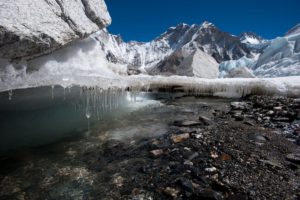
The northern part of the country is covered by the Himalaya mountain which is the highest mountain system of the world.Geologically,the Himalaya is a young lofty mountain system.There are quite a large number of snow covered peaks including eight of the world’s ten highest peaks.It is generaly believed that the Himalaya is still rising.The average height of this region is 5000 metres above sea level.As such there is perennial snow cover in the higher altitudes of this region.The Himalayan region can be sub-divided into three sub-regions of the main Himalayas; Tibetan Marginal Mountain; and the Inner Himalayan valleys.About 15 per cent of the total area in Nepal used to remain under snow cover. Now due to global warming and climate change the glaciers in the Himalayan region are fast retreating and the snow covered areas in Nepal are on decline. During the last 30 years, there has been decline of 21 per cent of the total snow covered areas.
In between the main Himalaya ranges and the southern most range of the Mahabharat there is an extensive belt of hills and valleys,often referred as Midland Pahar region.The southern part of the midland region is characterized by longitudinal valleys that run east – west parallel to southern most Mahabharat range.In the northern parts,however,we find the north – south trending valleys with alternating southern extensions of the Himalayan spurs.In between the Mahabharat and Chure ranges there are quite a few elongated valleys commonly referred as Inner Terai.The Inner Terai valleys between the Mahabharat range and the Chure range do not form a continuous stretch.The Inner Terai valleys are quite extensive in Dang and Chitwan districts.
The southern part of the country is a plain area.It rises only upto 300 metres above sea level.The Terai region is relatively wide stretch of lowland which merges with the Ganga plain of India to the south.The Terai region is made of alluvial soils and highly productive land.The Terai region can be sub-divided into two distinct parts of northern Terai and southern Terai.The northern part of Terai is often covered with dense forest of 13 kms wide and a long Bhabar tract of bushy and grassy tracts.The Bhabar tract is generally made of sand & gravels and stretches along the foothills of the Chure range,where most of the small rivers filter down and reappear a few kilometres to the south. The Southern Terai is a flat lowland formed of alluvial soils and highly productive for farming.The southern Terai is relatively densely populated.
Nepal, being a transitional country between Tibet Autonomous Region of China and India, can play a pivotal role so far trade between Tibet Autonomous region and India is concerned. In the historical past Nepal had handled much of the movement of goods between Tibet and India. The trans-Himalayan trade was conducted via traditional Himalayan trade routes of Nepal. China has made substantial investment in developing infrastructure in Tibet Autonomous Region.Highways have linked Lhasa with Shigatse,Saga,Parga and Purang ; Lhasa with Shigatse- Lhasa- Nyalam and Kodari.Roads have been constructed from these highways to Tibetan border towns along the northern Nepal border and even roads have been extended to the base camps of most of the important peaks of Mt. Everest ( northern route), Mt. Cho Oyu; Mt.Makalu; Mt.Lhotse; Mt.Shisha Pangma and other peaks in Tibet.Some of the important Himalayan settlements of Nepal have access to Tibetan roads in Taplejung, Dolakha, Sindhupalchok, Rasuwa, Mustang, Dolpa and Humla districts.
The road linking Trisuli-Bidur-Dhunchhe to Kyirong is already nearing completion and has been extended to Bharatpur via Gulchhe,this will provide shorter and direct road route from Tibet to India via Bidur, Bharatpur and Siddharthanagar.This may in future further enhance the flow of goods and movement of the people between India and Tibet Autonomous Region. Now with the develoment of railways and highways in Tibet Autonomous Region, there might be entirely a different network of road linkages towards the northern border of Nepal.
Many refer to landlocked and mountainous nature of the country as serious bottleneck for economic development of Nepal. But there are highly developed landlocked and mountainous countries like Switzerland and Austria in Europe. These countries have well developed networks of infrastructure linked with neighbouring countries of Germany,France and Italy that provide easy access to sea ports. Nepal has been depending entirely on the sea port of Kolkatta. Nepal should look to alternative sea port of Mumbai in India, Dhaka in Bangladesh and should also make of best use of road links to Tibet Autonomous Region and China.
Nepal is a country of multi-linguistic, multi-ethnic, multi-religious and multi-cultural groups. According to the census of 2001, there are 101 ethnic castes. The following eleven ethnic castes of Chhetri, Bahun, Magar, Tharu, Tamang, Newar, Rai, Limbu, Gurung, Musalman and Yadav seem to be prominent in Nepal. Similarly, there are about 92 linguistic groups in the country. Besides Nepali, the other major ten linguistic groups are Maithali, Bhojpuri, Tharu, Avadi, Tamang, Newar, Magar, Rai, Gurung and Limbu.
In the recent years, security has been a big problem along the porous southern borders; this has greatly affected the life of the people in Terai region. Due to frequent strikes, Chakajam and load shedding of electricity supply, the manufacturing industries have not been running smoothly. These have been serious bottlenecks to hotel industries, economic, commercial and service activities.
The Interim Constitution of Nepal after the Fifth Amendment has already incorporated the provision of federal system. The country at present has been divided into five development regions; seventy five districts; ninety-nine municipalities including one metropolitan city & four sub-metropolitan cities and 2915 village development committees.The country was sub-divided into fourteen administrative zones.The Zonal concept is still very much in practice and thinking of the people. In my view, it will be very difficult to erase out the zonal and development regional conceptual linkage from the mind of the general people.
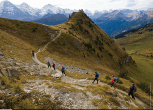
Development efforts have been mainly concentated in the Terai region and the Kathmandu Valley. Due to the lack of required infrastructure, large parts of the midland pahar region and Himalayan regions have remained relatively backward so far economic development is concerned. In certain parts of the Himalayan region, like Solukhumbu, Mustang, Manang and Rasuwa districts, there have been positive impacts of trekking and mountaineering on the livelihood of the local people. The average income of the Himalayan people along the major trekking routes has been relatively higher. There are potential areas in mid-western and far western Himalayan regions like Khaptad National Park, Rara National Park, and Shey Phoksundo National Park. These national parks and the Himalayan peaks need to be promoted for adventure tourism, trekking and mountaineering. Eco-trekking routes, camping sites, village resorts and related activities need to be developed in the mid-western and far western Himalayan regions.
Quite a number of proposals of dividing Nepal into several federal units ranging from six to fourteen have already been submitted for the consideration of the Constituent Assembly. The United CPN Maoist party has suggested thirteen provinces of Limbuwan, Kirat, Kochila, Mithila, Bhojpura, Newa, Tambasaling, Tamuwan, Avad, Magarat, Tharuwan, Bheri-Karnakli and Seti-Mahakali. Except Bheri-Karnali and Seti-Mahakali,the rest of the proposed elevan federal provinces are exclusively based on ethnic castes and linguistic groups. The CPN/UML party has suggested the establishment of three-tier system of federal democratic governance at central, regional and local levels. However, Nepali Congress party has emphasized on federal system of seven federal provinces. The committee on “State Restructuring and State Power Sharing” constituted under the chairmanship of Mr. Lokendra Bista Magar has recommended 14 federal provinces.
Nepal as a least developing country has to depend to a considerable extent on bi-lateral and multi-lateral support for the economic development of the country. In this context, we need to consider seriously the number of provinces to be set up in the country. We should take into consideration issues like national integrity, sovereignty, geographical specialty, ethnicity, castes, and languages, cultural and social identities in determining the number of provinces and in the demarcation of the provinces. Drastic changes are expected in political geography of Nepal.
The Terai region has now been commonly referred as Madhesi Pradesh. Even a demand of one Madhes – one Pradesh has been forwarded for consideration of Constituent Assembly. But the Terai region as a whole is so diversified in languages, ethnicities, castes, culture and other aspects, it will be very difficult to lump all the Terai districts into one province. The recently constituted commission under the co-ordinatorship of Dr. Madan Pariyar should base their analysis of cultural identities, economic viabilities, ethnicities, castes, languages geographical specialities, infrastructure, natural resources and the potentialities on the basis of the present 75 districts of Nepal. The data regarding population, infrastructures, economic & social conditions, governance & political system, development and other aspects are available for all the 75 districts. Keeping in view, of the limited period of two months, the commission should demarcate the boundary of the proposed federal provinces on the basis of the district boundary.
Similarly, the dependence of Nepal on India will relatively decline with the development of infrastructure of highways and railways linking to certain settlements in Tibet Autonomous Region close to Nepal’s northern border. The flow of goods and movement of the people across the northern border will be quite significant and may lead to transformation in economic geography of Nepal in future.


